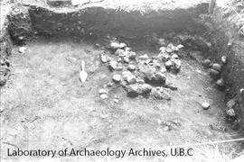
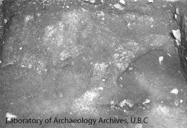
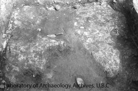
Overview of bottom of level 8 of N(2-4) E(20-22)
- LoAA 9.1-3-03-12
- Item
- August 22, 1972
This image shows a hearth feature along the south wall. Trowel is pointing north.
1007 results with digital objects Show results with digital objects
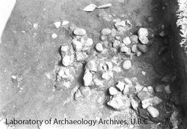
Overview of bottom of level 8 of N(2-4) E(20-22)
This image shows a hearth feature along the south wall. Trowel is pointing north.
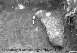
Overview of bottom of level 8 of N(2-4) E(20-22)
This image shows a hearth feature along the south wall. The trowel is pointing north.
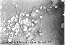
Oerview of N (8-10) E(16-18) at the bottom of level 11
This image was taken to show the pedestaled light brown ash. Image taken from the west.
Close-up of ash feature of N(8-10) E(16-18)
This image shows a close up of ash feature shown in image 14 of this file.
Overview of N(8-10) E(16-18) at the bottom of level 11
This image was taken to show the pedestaled light brown ash. Taken from north.
This image shows Stewart Point at age 6.
Overview of ash feature #3 in S(0-2) E(16-18)
This image was taken to show the ash feature number 3. The photograph log indicates that the south end of the pit is at the bottom of level 12. Taken from the west.
Ash feature #3 in S(0-2) E(16-18)
This image was taken to show ash feature number 3. Image taken from the west.
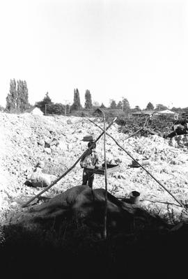
This image shows Wayne Point working at a screen. Photograph log indicates this image is frame 2, however, it is actually frame 4.
Overview of ash feature in N(2-4) E(20-22)
This image was taken to show the ash feature in the excavation unit. The photograph log indicates that the trowel is pointing north and the image was taken from the west.
View of collapsed boards of second grave house
The boards shown in this image are the same as shown in items 4-6 in this file.
View of collapsed boards of second grave house southern half
The boards shown in this image are the same as shown in items 3-6 in this file.
View of collapsed boards of second grave house northwest
The boards shown in this image are the same as shown in items 3-6 in this file.
View of collapsed boards of second grave house southwest
The boards shown in this image are the same as shown in items 3-6 in this file.
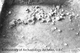
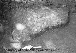
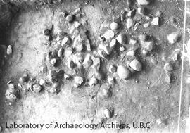
Overview of bottom of level 7 N(2-4) E(20-22)
The photograph log indicates that this image shows a rock feature and was taken from the north.
Overview of southern half of N(2-4) E(20-22)
This image shows the bottom on level 7 showing a rock feature in the sourthern half. Image taken from the north.
Overview of southern half of N(2-4) E(20-22) from east
This image shows the bottom of level 7. Taken from the east.
This file contains the images taken on roll 4 using the Konica camera designated for fieldwork photographs taken during the course of the project in 1972. In addition a photograph log, and contact sheet of the negatives are in the file.
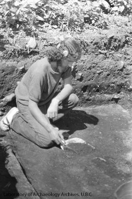
This image was taken showing Pete Flagg uncovering an artifact.
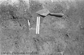
This image was taken to show a close up of the artifact uncovered in frame 2 (item 1 in same file). Image shows a 15cm ruler for scale and a trowel pointing north.