- 7.1FNF-01-02
- File
- 1967-1968
This file contains duplicate entries of catalogue numbers (1201-1455). It also contains a floor plan drawing and an annotated copy of the site survey form.
1007 results with digital objects Show results with digital objects
This file contains duplicate entries of catalogue numbers (1201-1455). It also contains a floor plan drawing and an annotated copy of the site survey form.
This file contains listings of artifacts by common name.
Field notes related to archaeological work performed by Charles Borden and his crew.
This file contains the field notes produced from archaeological activity at the Musqueam north site. These notes have been arranged by unit, each section containing the daily log, images, and maps related to the unit.
This series contains the photographs and logs produced from the the work performed at the site by Charles Borden and his crew. The series consists of fourteen files. Each file relating to one roll of film. Rolls of film were numbered by year fo...
This series contains the maps created during work at the Musqueam north archaeological site. Profile maps were most likely drawn by Moira Irvine.
This file contains profile maps and a computer printed copy of each map. Profiles are attached together with tape in sets of 3 and 4. Each profile is titled separately.Maps in this file are titled:South face at S78 from E 428-433west face at E42...
This file contains profile maps and plans of DhRt-3, Musqueam North.
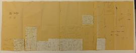
DhRt 3 floor plans L-4 A-9/1.75
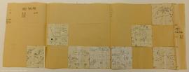
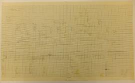
This floor plan longitude and latitude lines have been drawn on one sheet of paper. Details have been drawn on graph paper squares (12.5 cm sq.) and stapled in place on the larger sheet. Not all squares have been attached. For unattached square...
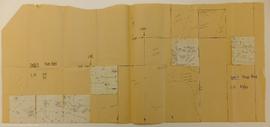
DhRt 3 floor plans L-6 A-9/2.25
This floor plan longitude and latitude lines have been drawn on one sheet of paper. Details have been drawn on graph paper squares (12.5 cm sq.) and stapled in place on the larger sheet. Not all squares have been attached. For unattached square...
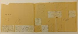
This floor plan longitude and latitude lines have been drawn on one sheet of paper. Details have been drawn on graph paper squares (12.5 cm sq.) and stapled in place on the larger sheet. Not all squares have been attached. For unattached square...
This floor plan longitude and latitude lines have been drawn on one sheet of paper. Details have been drawn on graph paper squares (12.5 cm sq.) and stapled in place on the larger sheet. Not all squares have been attached. For unattached square...
DhRt 3 (Musqueam N.) site survey
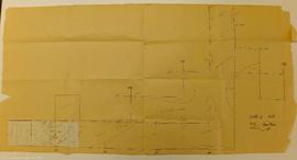
This map shows the profile of trench A.
DhRt 3 floor plans L-5 A-9/2.0
This floor plan longitude and latitude lines have been drawn on one sheet of paper. Details have been drawn on graph paper squares (12.5 cm sq.) and stapled in place on the larger sheet. Not all squares have been attached. For unattached square...
DhRt-3 floor plans L-9 A-9/3.0
This floor plan longitude and latitude lines have been drawn on one sheet of paper. Details have been drawn on graph paper squares (12.5 cm sq.) and stapled in place on the larger sheet. Not all squares have been attached. For unattached square...

This floor plan longitude and latitude lines have been drawn on one sheet of paper. Details have been drawn on graph paper squares (12.5 cm sq.) and stapled in place on the larger sheet. Not all squares have been attached. For unattached square...
Profile looking west of E365 from N5 to S25
Profile of E360 face looking west from south 0' to south 25'
Marpole DhRs 1 Arrowstone Dave Hall 2005 File
Part of Laboratory of Archaeology fonds
File contains correspondence concerning the possibility of the Laboratory of Archaeology acting as the repository for material recovered, by Arrowstone Archaeological Research and Consulting, at the Marpole Site.