Bereich 'Titel und Anmerkung zur Verantwortlichkeit'
Haupttitel
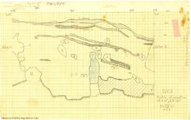
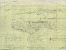
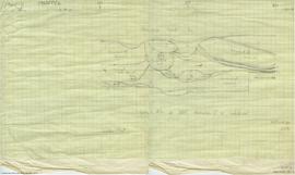
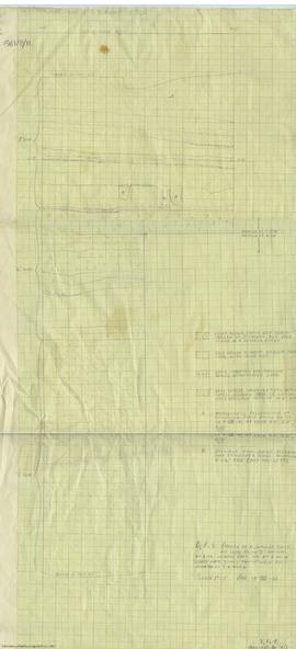
Maps
Allgemeine Werkstoffbezeichnung
- Kartografisches Material
Paralleler Titel
Andere Titelinformation
Titelangaben zur Verantwortlichkeit
Anmerkungen zum Titel
Erschließungsstufe
Serie
Identifikator/Signatur
17.1-04
Bereich "Edition"
Edition statement
Edition statement of responsibility
Class of material specific details area
Angaben zum Maßstab (kartografisch)
Angaben zur Projektion (kartografisch)
Angaben zu Koordinaten (kartografisch)
Angaben zum Maßstab (architektonisch)
Issuing jurisdiction and denomination (philatelic)
Bereich "Entstehungszeitraum"
Datum/Laufzeit
Bereich 'Physische Beschreibung'
Physische Beschreibung
29 maps
Publisher's series area
Haupttitel der Verlagsreihe
Parallel titles of publisher's series
Other title information of publisher's series
Statement of responsibility relating to publisher's series
Numbering within publisher's series
Note on publisher's series
Bereich "Archivische Beschreibung"
Name des Bestandsbildners
(1905-1978)
Bestandsgeschichte
Eingrenzung und Inhalt
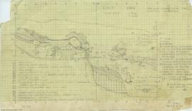
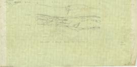
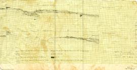
This series contains all of the maps created from archaeological activity at the Milliken Archaeological site between 1960-1961.
Bereich "Anmerkungen"
Physischer Zustand
Abgebende Stelle
Ordnung und Klassifikation
These maps were housed in map drawers according to site separated from their original context. Maps have been arranged into this series based on their date of creation and content that indicates they were created by the Dr. Charles Borden DjRi-3 project.