Title and statement of responsibility area
Title proper
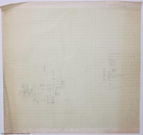
Marpole W10-150/S100-200 and E0-40/N50-200 together on one sheet
General material designation
- Cartographic material
Parallel title
Other title information
Title statements of responsibility
Title notes
Level of description
Item
Reference code
05.1-4-I36
Edition area
Edition statement
Edition statement of responsibility
Class of material specific details area
Statement of scale (cartographic)
Scale [1:12] (Scale statement is 1 inch equals 1 foot)
Statement of projection (cartographic)
Statement of coordinates (cartographic)
Statement of scale (architectural)
Issuing jurisdiction and denomination (philatelic)
Dates of creation area
Date(s)
-
[1955] (Creation)
Physical description area
Physical description
2 plans on one sheet : ms., pencil on graph paper ; 51x54 cm
Publisher's series area
Title proper of publisher's series
Parallel titles of publisher's series
Other title information of publisher's series
Statement of responsibility relating to publisher's series
Numbering within publisher's series
Note on publisher's series
Archival description area
Name of creator
(1905-1978)
Custodial history
Scope and content
Maps show locations of soil changes and post holes, maps are from W10 - 150 and S100 - 200 and E0 - 40 and N50 - 200, respectively. A note on the back of the map suggests that it corresponds to the schematic map of the excavation unit.
Notes area
Physical condition
Immediate source of acquisition
Arrangement
Language of material
Script of material
Location of originals
Availability of other formats
This map has been digitized by LOA staff.
Restrictions on access
Terms governing use, reproduction, and publication
Under Copyright.
Finding aids
Associated materials
Accruals
Alternative identifier(s)
Standard number area
Standard number
Access points
Subject access points
Place access points
Name access points
Genre access points
Control area
Description record identifier
Institution identifier
Rules or conventions
Status
Level of detail
Language of description
Script of description
Digital object metadata
Filename
5x1-04-I36.jpg
Media type
Image
Mime-type
image/jpeg
Filesize
353.4 KiB
Uploaded
January 4, 2013 1:23 PM